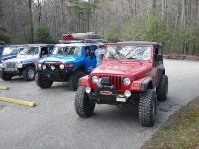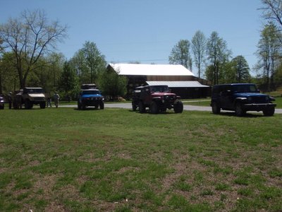
Exploring WNC April 2011

97TJGUZZY

SUPPORTER
Here is steves write up of the trip. I only took a few pictures but we all had a great time.
http://southeastoverland.com/blog/3-trips/58-exploringwncapril14172011.html

I had been hoping to make it out to do some further exploring of western North Carolina for many months and the time had finally come. Myself and Brooks from OffroadSC.com had both spent hours upon hours pouring over Motor Vehicle Use Maps (MVUMs) to locate areas that might be fun to travel. The idea for this trip was pretty basic. I wanted to explore a few USFS roads and take a few days away from the office. Now don't get me wrong, I LOVE what I do, but there comes a point where you have to stop eying your toys and start using your toys! As the time got closer several people contacted us and wanted to follow us. This was a fun trip - even with 6" of rain falling over 12 hours.

image.raw


image.raw


image.raw


image.raw


image.raw
 
Our basic route started in western NC, we skirted Asheville and camped. We spent just a little more time than I planned on the trail the first day as we had to clear a few trees from the trail. The next day we hit the Blue Ridge Parkway south of town. We took the BRP to Linville Gorge and stayed in Mortimer for two nights.

image.raw


image.raw


image.raw


image.raw


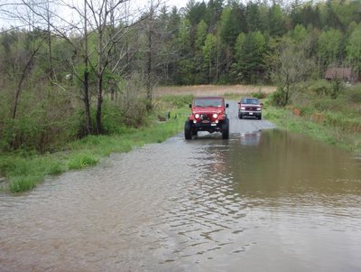
Friday night the rain hit and 6" fell pretty quickly. A tiny creek that ran adjacent to the campsite flooded a bridge and backed well up the road and almost into camp. Volunteer Fire came by and suggested we leave. After a short chat we assured him we were OK and were actually enjoying the weather. He agreed that we were OK and turned his attention back downstream where 2 RVs had washed downriver with 9 people inside. Luckily everyone was rescued.

image.raw


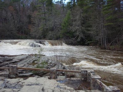
This was supposed to be a little creek beside the campsite. 6" of rain did a number on all the creeks and rivers.


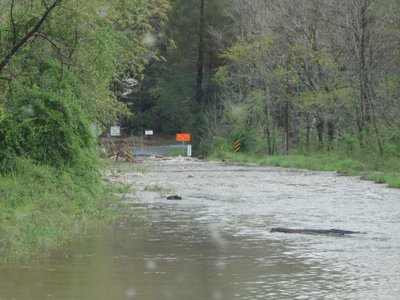
Once the rain cleared we headed northeast towards Banner Elk. Part of the group was turned around twice by washed out bridges but we all eventually made it. After lunch in Banner Elk we headed over to Linville Gorge and Linville Falls before making it back to camp.

image.raw


image.raw

And also looked around the ghost town of Mortimer.


It was amazing how fast these 4 days went by. I had a blast and enjoyed meeting so many new people! I will be further exploring this area with the final goal to provide maps of legal roads that can be traveled. Remember - it is very important to tread lightly and to also only travel on legal roads. What takes so long scouting is the time it takes before hand pouring over MVUMs to ensure we are only on legal roads.

Anyways, I hope you enjoy the pics. There is not much better than new friends hitting FS roads to enjoy a few days off the beaten path!
 
here are some of the pics I took

attachment.php

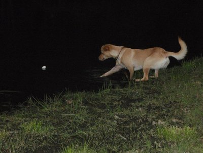
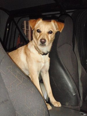
Roxie Ready to Go

attachment.php

Roxie trying to swim the marshmallow toward her

attachment.php

Trying to get to Blowing Rock for lunch....seems the road is no longer there...

attachment.php

This is what I saw from my jeep...

attachment.php

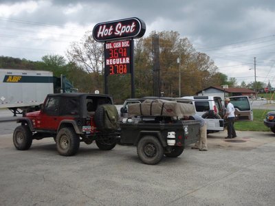
Getting gas after leaving first camp on the way to the Linville Gorge argea.
 

Attachments

  • SEO Spring Trek 029.jpg
    SEO Spring Trek 029.jpg
    97.1 KB · Views: 111
  • SEO Spring Trek 030.jpg
    SEO Spring Trek 030.jpg
    96.3 KB · Views: 111
  • SEO Spring Trek 023.jpg
    SEO Spring Trek 023.jpg
    96.2 KB · Views: 110
  • SEO Spring Trek 016.jpg
    SEO Spring Trek 016.jpg
    95.1 KB · Views: 110
  • SEO Spring Trek 010.jpg
    SEO Spring Trek 010.jpg
    96 KB · Views: 109
attachment.php

attachment.php

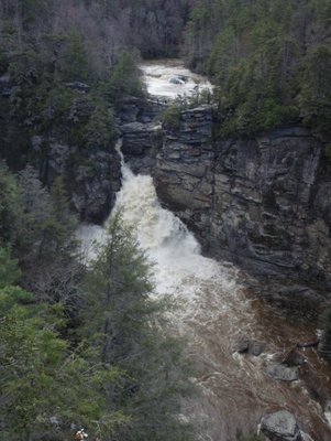
Here is the view we had of linville falls at flood stage

attachment.php

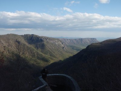
My first time in Linville Gorge, wow thats awesome

attachment.php

attachment.php

on the road
 

Attachments

  • SEO Spring Trek 047.jpg
    SEO Spring Trek 047.jpg
    86.7 KB · Views: 107
  • SEO Spring Trek 039.jpg
    SEO Spring Trek 039.jpg
    94.8 KB · Views: 107
  • SEO Spring Trek 033.jpg
    SEO Spring Trek 033.jpg
    96.4 KB · Views: 108
  • SEO Spring Trek 046.jpg
    SEO Spring Trek 046.jpg
    97.6 KB · Views: 107
  • SEO Spring Trek 050.jpg
    SEO Spring Trek 050.jpg
    96.3 KB · Views: 107
Man it looks like a great trip. I hate I missed it, my motor took a poo on the cruiser. As soon as its back together id like to make it back up there.
 
Looks like a fun time, wish I had known about the trip. I've been doing the same thing, spending free time looking over maps looking for legal routes to check out, probably not near as much as you guys do.
 
If you ever get up that way there are tons of fs roads to check out. I plan to head back up to the Harmon Den area sometime soon.
 
awesome looking trip guys. say wld that be a unimog i see in the last pic? if so it looks ALOT like one i see around anderson a good bit
 
that is pat harris, he works in the Strom thurmond institute at clemson. He is the Clemson Offroad Club advisor as well. So yes, thats the one you have seen haha.
 
so were these pretty well maintained roads that just were not used? or were they trails like the ones to Bumpus Campsite? This is the sort of thing I think Lori would love...as long as it wasn't all bouncy and off camber like :)
 
They are legal USFS roads that have been maintained recent enough that they are easily passable. Think of 'em as a one lane road. I'll be headed back up that way maybe in July. I've already scouted via a map enough roads to keep us in one area for probably two days. No hard core wheeling and much of the area can be done in 2WD - but you are 'off the beaten path' and 4WD is required in a few places.
 
We might tag along as well if you don't mind. My wife and I are from this area and we hit the FS roads all the time! Wish we would have known about this trip! Keep us in the loop...

-Jason
 
Back
Top